A Tale of Some Old Tech That Keeps Getting Better
Its all about the Maps!
My friend in Denmark told me Russians are jamming GPS in the Baltic Sea and he was fed up with it. My imagination zone went to GPS spaceships flying high above the earth firing lasers at each other. I’d like that better than drones over Ukraine1.
GPS jamming turns out to be like any radio jamming - churn out signals at the right frequency and intensity to interfere with the source and the system gets confused. Check this cool Live GPS spoofing map, the first of many delightful maps in this article!2
While GPS spoofing/jamming may not be that remarkable, GPS or the Global Positioning System is. GPS is tech that qualifies as magic when you don’t understand it.3 I try to know enough about all things tech/mechanical that I depend on, but I know nothing about GPS.
Knew nothing. Now I know enough and soon you will too and we’ll get into more cool maps.
I have three recent GPS run-ins that we’ll use to go through how GPS works:
My dads burial at sea has these coordinates: 33°57'11.3"N 118°30'38.5"W
Dillon Beach wants you to know YOUR GPS DOESNT WORK HERE
My tired legs couldn’t make it straight up a steep hill so I had to wiggle side-by-side aka Serpentine
1. The Basics. We slice up the earth into ever tinier squares like a giant round chessboard
In elementary school you learned about Latitude and Longitude. If you were really lucky you got to play with a globe that spun around and maybe you spun it too fast and broke it or maybe you threw it across the room because it looked like a ball and dented it or maybe that was just me.
Could be why I don’t remember any of this, but that’s ok AI caught me up pretty quick. You know the Equator? That’s the Earths belly button line. Latitude lines run parallel to that horizontally up and down across the Earth. They aren't for real. They measure how far North or South you are of the Equator. The North Pole is 90 degrees North or N and the South Pole is 90 degrees South or S. Each line is 1 degree so 1° to 89° N up to the North Pole and 1° to 89° S to the South pole.
Longitude runs perpendicular to Latitude or up and down vertically. The Equators equivalent running North-South is called the Greenwich Prime Meridian and it passes through both the North and South Pole. These lines are also not real. They cover the top and bottom of a round Earth so they are 180 degrees apiece respectively. So we get 1° to 179° East or E if you are to the right of the Prime Meridian and 1° to 179° West or W if you are to the left. So far so good.4
Now that we have this imaginary grid of Latitude and Longitude lines criss-crossing the earth, we can use ever more precise measurements of them to mark any spot. The most common way to designate a spot is degrees, minutes and seconds. The more numbers you got, the more precise it gets. The numbers are labeled N, S, E or W so you know which side they're on. Two sets of numbers mark a spot. There are other formats but you get the idea. If you are after a career in cartography5, you’ll have to go read some other articles and figure that out.
Put my dad’s numbers into Google Maps and here is where he started his journey into the great Pacific Ocean. Cool map #2.
2. YOUR GPS DOESNT WORK HERE. You need to be able to see a lot of sky.
It’s been hot here in Santa Rosa, over 100 degrees this week. Is it hot where you are? What’s a heat dome? Why is weather terminology increasingly dramatic?
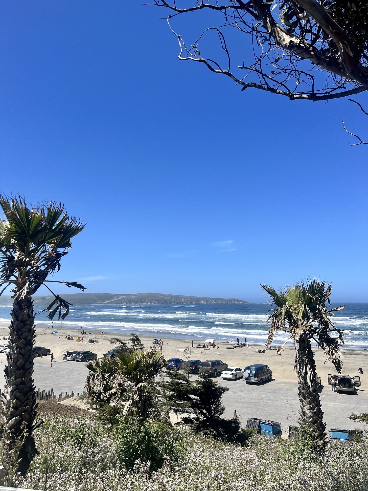
It’s cool at the ocean so we biked to a beach called Dillon. Dillon Beach Road winds through a canyon before it opens up to the coast. On the way, there is a dire sign warning Your GPS is Wrong! I wanted to take a picture of the sign but my survival instincts kicked in, so here’s a picture where we stopped at the beach instead:

Even though I said spaceships, Pew Pew Pew! GPS really runs on Satellites. Here’s what you need to know about these satellites:
You need line of sight to 4 of them for GPS to work. One for Latitude, one for Longitude, one for Elevation and the last one for time sync.
32 active satellites form the GPS network up from 24 originally.
They are maintained by the US Space Force at a cost of over $3M a day
GPS was was originally built by the DoD for national defense and so the satellites had a limiting feature called Selective Availability that made GPS signals inaccurate for civilian use. In 2000, President Bill Clinton decided to turn SA off and wam bam zowie that unleashed magic for everyone.
The doppler effect is central to GPS finding you. The wavelength of a moving object changes in predictable ways so that determines location and speed
GPS Satellites move so fast and their signals travel so far that both Einstein’s special and general relativity theories must be used to adjust the time broadcast from the atomic clocks in each satellite
The GPS system is passive, constantly broadcasting location and time coordinates to receivers on the ground that ingest the data without sending anything back, so there are no limits to the scalability of the system.
I could keep going with this list, the GPS system is really quite amazing. #1 is why GPS might not work on Dillon Beach Road. The first GPS system was up and running over 30 years ago in 1993 with 24 satellites and now we can’t live without it.
3. GPS is crazy accurate. Now everyone knows I couldn’t ride up that hill.
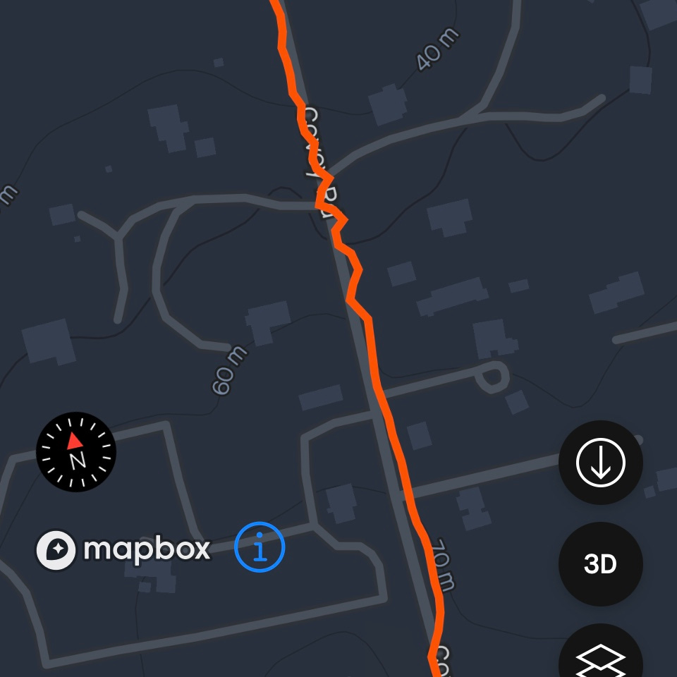
My first ride after a few weeks off was a little rough. Went up a big hill and wanting to get home to take a nap choose the shorter but harder way back. This meant going up a stretch called the Covey Wall which is 200 feet straight up in maybe a quarter mile. Steep. The only way my tired legs could get up Covey Road was by twisting in an S serpentine style back and forth across Covey.
GPS tells no lies:
You can even see where I got stuck on the other side of the road waiting to crest the hill so I could see the cars coming at me. That’s cool map #3 and here’s #4 of the ride to Dillon Beach which looks to me like Llama sitting down wearing a beret and possibly peeing?
When Bill Clinton enabled GPS for civilian use 24 years ago it started a crazy productivity cycle with consumer GPS and it just keeps getting better and we rely on it so much. My bike computer can talk to other positioning satellite systems for more accuracy and redundancy. In addition to GPS, your phone can triangulate your location when you're out of sight of satellites using Cell Towers and WiFi.
After I wrote everything above this line I suspect my friend in Denmark leaked my intentions to the New York Times. They had the audacity to beat me to this scoop it by publishing an article on GPS Jamming on Wednesday. It’s a very good and informative article in a beautiful visual format (albeit a bit of a downer) so I’m calling it cool Map #5 and here’s a gift link so you can read it now with context:
Final cool stuff about GPS plus one more map:
If you’re hiking off the grid, GPS will still work - now you know why. Your maps might not load though because you’ve no cell/data signal. So download those maps before you hit the trail or get a purpose-built GPS device that will do it for you and also send and SOS if need be. Like this guy.
Heard of Geocaching? It’s a global treasure hunt especially popular with kids where you look for stuff using GPS and get prizes. Treasure Maps! There are over 3 million active geocaches worldwide.
Spiderman uses Spider-Tracers to track his enemies and now you can use them to track your luggage via air tags and tiles. Do you count Sharks in your enemies? One last cool map for the week - Shark Map!
best, Andrew
If you’re new to Tech Tales and missed it, check out one of my first articles which is more about GPS and Maps and also Cookie Monster:
Can I eat ALL the Cookies 🍪🍪🍪
This week we talk cookies. We start with the ones Cookie Monster loves and end up with the ones that browsers leave on your computer. The browser kind are now regulated resulting in an endless and annoying parade of pop ups asking you for consent when you visit a website. Like my post on
If you are having an shortage of things to worry about, here are a couple of interesting articles I found looking into this. This one is about a big NATO war games operation last week in the Baltic Sea (BALTOPS-24) and this one is a play-by-play of every time NATO jets scrambled to intercept Russian fighters flying overhead across Baltic borders (thank you Republic of Lithuania).
Have you ever read a book that had a Map and you kept referencing it? Maps bring a sense of place and hint of other stories to be told of a place. Same with shows and online worlds. The map in the opening scene of Game of Thrones was so enticing, giving new clues and insights to new lands and landmarks every season.
“Any sufficiently advanced technology is indistinguishable from magic” Arthur C. Clarke
If you want to spin a virtual globe and get a better idea how all these lines look check the Encyclopedia Britannica
Study and practice of making and using maps, combining science, aesthetics and technique Cartography - Wikipedia


I love the maps! Didn't know they existed, but that's because I haven't thought to look. Your wit ties all of this together beautifully. Great read Good Sir!